Skelmorlie Measured Mile
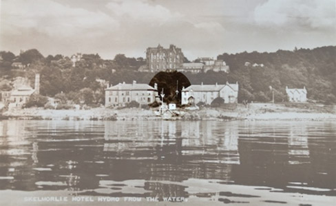
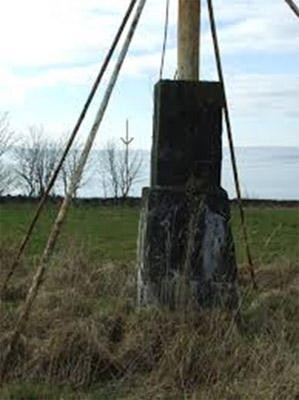
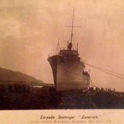
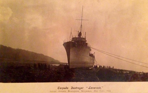
Photos: 1. Meadow Place (centre left), Eglinton Place (centre right) with the northern ‘Mile’ markers in between – courtesy of J B Spence. 2.Southern markers of Skelmorlie’s measured mile, near Skelmorlie Castle – copyright Thomas Nugent, geograph.org.uk. 3. HMS Laverock aground at Blackhouse (now Manor Park) – Facebook: Skelmorlie & Wemyss Bay in their heyday.
Research:
The Skelmorlie measured mile was created by John Napier (see note below) in 1866. It was one of the first of its type and it enabled shipbuilders to look for additional payments when ships exceeded the contract speeds laid down by ship owners (usually for each extra half knot of speed) but it also protected the owners from false claims made by the shipbuilders.[1]
Each of Skelmorlie’s beacons consisted of a single pole 45 feet high, with arms 10 feet long forming a broad angle 15 feet from the base, the whole being painted white. The two northern beacons were erected near Skelmorlie Pier, the outer one being close to high water and the inner one, 83 yards south east, in the recess of the cliff. The two southern beacons stand on level ground near Skelmorlie Castle, the inner one being 100 yards south east of the outer one. The “Mile” was at right angles to the line of transit of the beacons and a minimum of one third of a mile from the shore. To obtain an accurate measure, ships had to make at least four to six runs in both directions to allow for the wind and tide. [1] [2]
When the measured mile was built, speed was of immense importance and there was constant pressure to reduce passage and turnaround times to remain competitive. The introduction of the railway on parts of the route only added to this pressure and there was regular ‘racing’ between the passenger ships to reach the next location first. [3] [6]
Being in such busy waters and so close to the shore, inevitably, there’s been various mishaps on the ‘Mile’ over the years. The most serious incident happened in Sept 1907 and involved the “Kintyre” a cargo ship with bowsprit.
At the time, the “Maori” was on the ‘Mile’ completing the northward run and swinging into Wemyss Bay to prepare for another run south. Due to an error of judgement, she hit the “Kintyre” at some speed on the starboard quarter, only a hundred yards offshore. Fortunately, the “Kintyre” was carrying neither cargo or passengers. The crew were able to escape during the 5 mins the two ships were locked together but “the Captain, John McKechnie and Chief Engineer, William Lennox, gallantly stayed on the bridge declining all efforts to induce them to escape. The captain was ultimately rescued from the water when the ship went down, but the Engineer was never seen again”. [3]
In another well documented incident, HMS Laverock ran aground, off Blackhouse (now Manor Park) in early 1914. “The vessel was running her trials on the Skelmorlie measured mile, and had completed a downward trip, the weather at the time being wet but fairly clear, with a stiff southerly breeze”. She steered to port (towards the shore), when turning around for the run back and there seemed to be plenty of room. “It’s believed that the steering gear must have jammed in the course of the movement, as the vessel failed to come round sufficiently to clear a spit of land, and she steamed hard aground, practically abeam of the shore, and at a high rate of speed”. Although the vessel sustained some damage, she was salvaged and able to be repaired and enter service. [3] [4]
A measured “double” mile was erected in Arran in 1934 for the speed trials of Cunard’s Queen Mary and later a measured “half” mile was revived in the Gareloch, which was used to test the “jet propelled” 1888, Lucy Ashton and the first hovercraft. [1]
According to local man, Norman McMillan “We used the “measured mile” many times for trials of new ships and submarines built by Scotts S&E of Greenock.” [5]
However usage has fallen dramatically following the introduction of GPS based sea trials, twenty years ago. We believe the last use of the Skelmorlie Mile was in July 2016 for CalMac’s new Largs – Cumbrae ferry “Catriona”. [6]
Note: Robert Napier and Sons was a famous firm of Clyde shipbuilders and marine engineers at Govan, Glasgow founded by Robert Napier in 1826. It was moved to Govan for more space in 1841. His sons James and John were taken into partnership in 1853. The whole Clyde, every engineer and shipbuilder in it, was considered to have benefitted from the firm’s achievements and celebrity. By the 1840s it was universally recognised as the finest in Britain. Many other firms were founded by former employees. [7]
References:
- “Measured Mile was set out 125 years ago”, Largs & Millport Weekly News, 1991.
- “Measured Mile”, Wikipedia.
- “Skelmorlie -The story of the Parish consisting of Skelmorlie & Wemyss Bay” by Walter Smart, 1968.
- “Laverock”, by Valeman, 2019, Dalmadan.com
- Facebook: Skelmorlie & Wemyss Bay in their heyday – comments and photos on measured mile.
- “The Clyde’s Measured Miles”, by James Osborne, Clyde River Steamer Club.
- “Robert Napier and Sons”, Wikipedia.

